AERIAL SURVEYING
Flying Fox Drone Solutions provides photogrammetry and LiDAR aerial surveying services built around your project’s specific needs.
All survey data is geo-referenced and ready for integration into GIS platforms, enabling detailed spatial analysis, informed decision-making, and clear, defensible reporting for your site or project area.
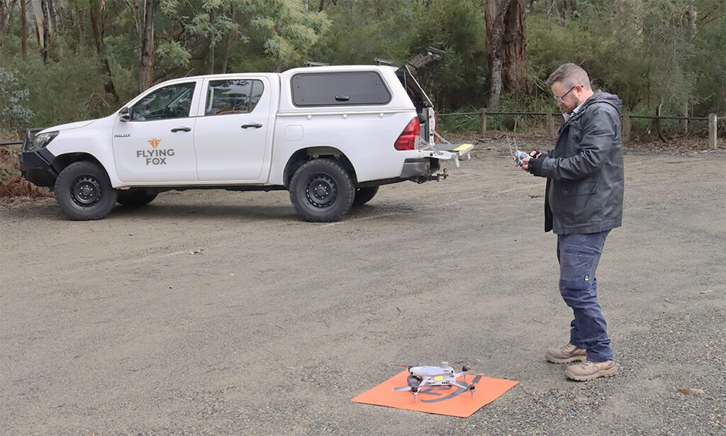
Every engagement begins with thorough flight mission planning. This includes site-specific safety assessments, CASA compliance checks, airspace authorisation and permit applications where required, and detailed flight path planning. Whether your site is straightforward or complex, our planning process is designed to give you confidence that the work will be carried out safely, efficiently, and to a consistently high standard.
Data processing is offered as a separate, optional service. If your organisation has existing processing capability or preferred workflows, we’re happy to provide raw data outputs. If you’d prefer a complete solution, we can take your data through to finished products.
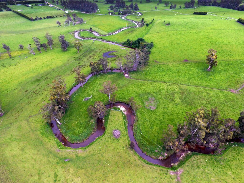
LANDSCAPE MAPS
General landscape maps
Landscape condition
Water level monitoring
Erosion monitoring
Quantification
3D models
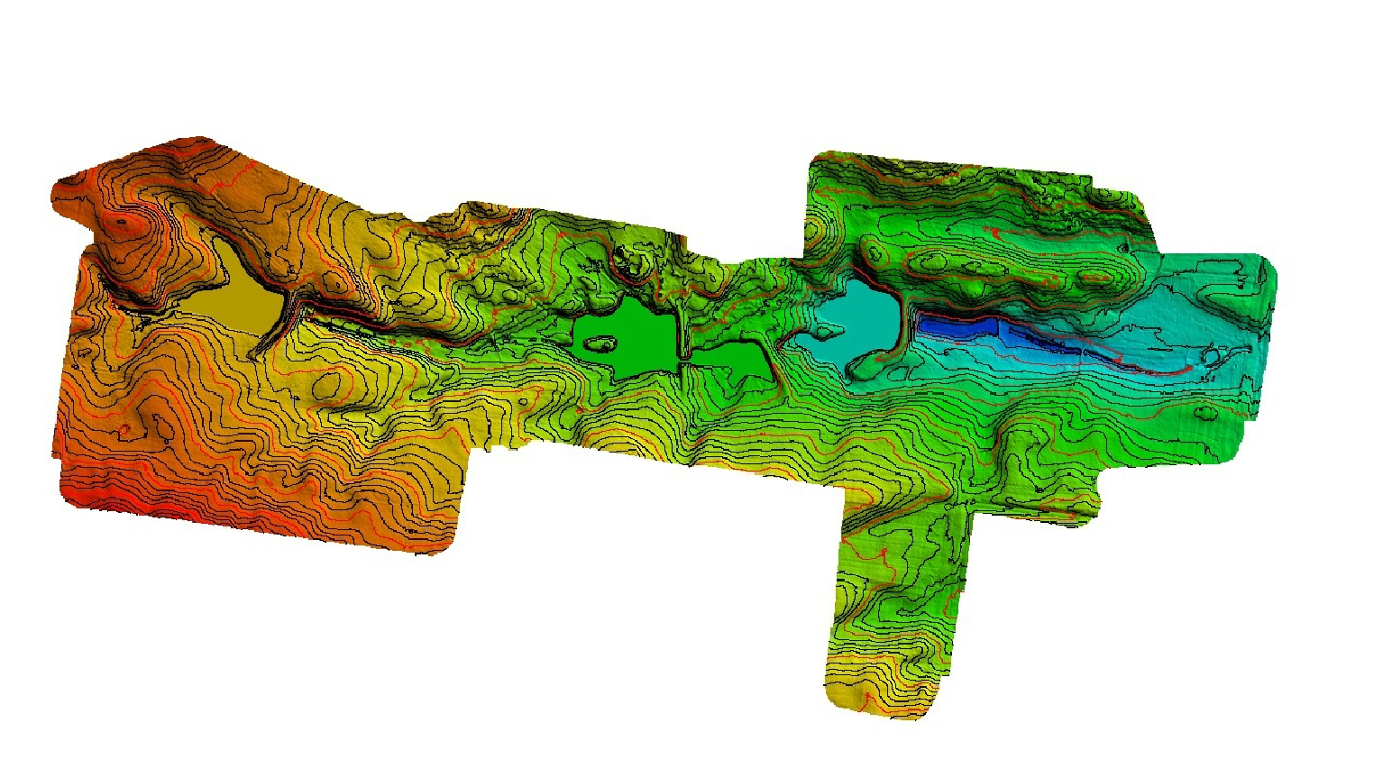
ENVIRONMENTAL ENGINEERING
In-depth terrain analysis
Erosion and hydrology structure
Riparian and gully morphology
Drainage and water-flow modelling
Understorey structure analysis
Biomass and fuel-load mapping
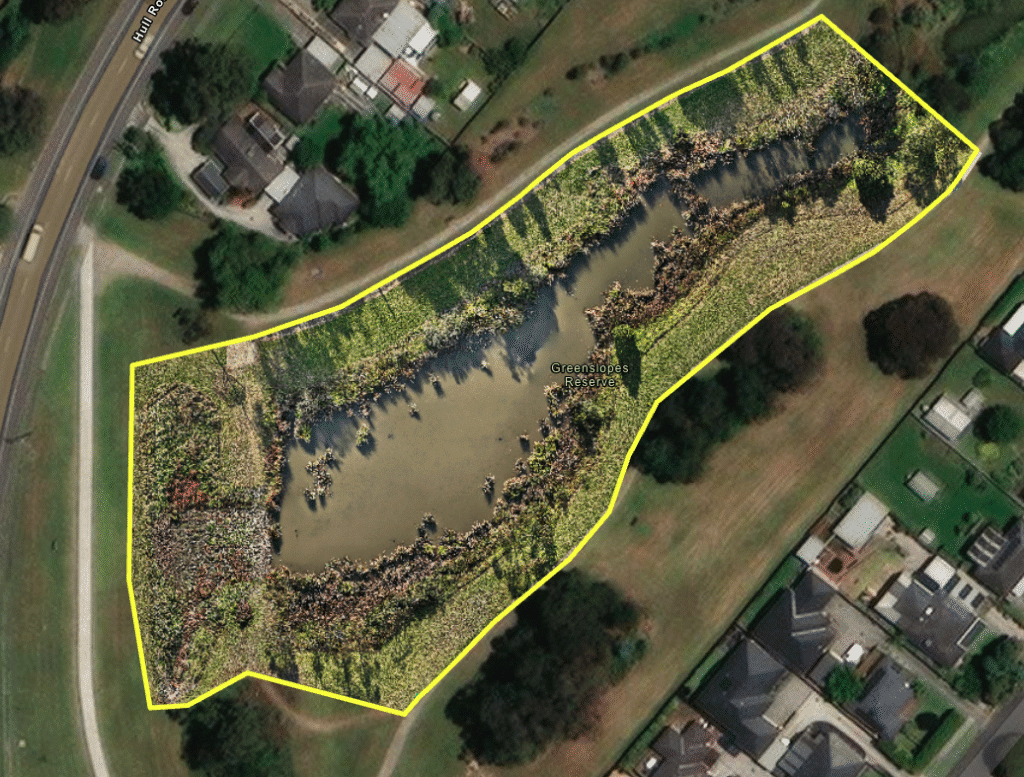
TERRAIN ANALYSIS
Terrain modelling
Canopy height and density
Riparian and gully morphology
Understorey structure
Biomass and fuel-load mapping
Water level monitoring
change over time
Restoration progress
Revegetation development
Vegetation composition changes
Documentation
VEGETATION ANAYLSIS
Weed mapping
Vegetation type mapping
Quantification
Canopy cover
Agricultural assessment
Water level monitoring
habitat condition
Vegetation suitability
Tracks and burrow detection
Canopy cover
Restoration progress
Documentation
our services
We offer two core aerial survey methods: photogrammetry and LiDAR.
If you’re unsure which method is best for your project, we are here to help! Get in touch and we can provide advice specific to your needs.

PHOTOGRAMMETRY
Photogrammetry is the process of using large numbers of overlapping aerial images to create accurate, geo-referenced maps and 3D models. Using a drone equipped with a high-resolution RGB (red, green, blue) camera, we systematically capture imagery across your survey area. That image set is then processed through specialised software, stitching the photos together producing a range of accurate, geographically referenced outputs – including orthomosaics (2D overhead maps), digital elevation models and 3D point clouds.
Compared to LiDAR, photogrammetry is a more accessible and cost-effective survey method, while still delivering a high level of detail and spatial accuracy. It is well suited to open or moderately vegetated environments where the ground and features of interest are visible from above.
For any client needing a clear, accurate, and up-to-date picture of a site or landscape, photogrammetry offers a reliable and cost-effective starting point.
LiDAR
LiDAR (Light Detection and Ranging) works by firing thousands of rapid laser pulses from a sensor on the drone toward the ground below. As each pulse hits a surface, it bounces back to the sensor, which measures how long the return journey took. From that, the system calculates precise distances and builds up a highly detailed, three-dimensional picture of the survey area.
What makes LiDAR particularly useful is its ability to see through vegetation. Where photogrammetry can only capture what’s visible from above, laser pulses can pass through gaps in a canopy and continue down through understorey layers all the way to the ground. This means you get a clear picture of both the vegetation structure and the terrain sitting beneath it, even in densely vegetated areas.
For environmental, ecological, and land management work, this opens up a range of applications that imagery-based surveys can’t easily deliver. This includes mapping habitat structure, monitoring vegetation condition, revealing subtle terrain features, modelling drainage patterns, and generating accurate ground surface models.
why choose us?
Our background in ecology means we understand the environments we work in and the decisions our data needs to support. We bring that knowledge into every project, alongside a genuine commitment to ethical operations, transparent communication, and culturally respectful practice. We take data sovereignty and Indigenous engagement seriously and work collaboratively with clients to make sure outputs are fit for purpose.
We hold all the necessary CASA licenses to operate legally and safely. This includes a Remote Operator’s Certificate (ReOC), Remote Pilot’s License (RePL) and Aeronautical Radio Operator’s Certificate (AROC). We also carry $20 million public liability insurance covering full flight and ground risks.
As a small business, we pride ourselves on being approachable with a practical focus on delivering what you actually need.